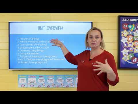
This unit is based on the Year 1 Australian Curriculum HASS Inquiry Skills, Knowledge and Understandings. Students explore the different features of places within the school environment. Students investigate what are, and how to care for, natural, managed and constructed features of the school and sort these into their categories. Students create a pictorial map of the school and use directional language to direct a peer around the school. Students look at the features of the school playground, and use this information to plan and design a new playground for the school.
Pose questions about past and present objects, people, places and events
Collect data and information from observations and identify information and data from sources provided
Sort and record information and data, including location, in tables and on plans and labelled maps
Interpret data and information displayed in pictures and texts and on maps
Draw simple conclusions based on discussions, observations and information displayed in pictures and texts and on maps
Reflect on learning to propose how to care for places and sites that are important or significant
Present narratives, information and findings in oral, graphic and written forms using simple terms to denote the passing of time and to describe direction and location
The natural, managed and constructed features of places, their location, how they change and how they can be cared for
Activities in the local place and reasons for their location
Demonstrates skills of historical inquiry and communication
Describes features of places and the connections people have with places
Identifies ways in which people interact with and care for places
Communicates geographical information and uses geographical tools for inquiry
Collect and record geographical data and information from the field and other sources
Represent data and the location of places and their features by constructing tables, plans and labelled maps
Interpret data and information to draw conclusions and describe the direction and location of places, using terms such as north, south, opposite, near, far
Natural, managed and constructed features of places, their location and how they change
Activities in the local place and reasons for their location, and the influence of purpose, distance and accessibility on the frequency with which people visit places
Identify the content features of primary sources when describing the significance of people, places or events
In this unit students explore the following concepts;
 Lesson 1
Features of a Place
Lesson 1
Features of a Place
In this lesson, students are going to be looking at the different features of our school.
 Lesson 2
Natural, Managed and Constructed Features
Lesson 2
Natural, Managed and Constructed Features
Students will learn how they can group different features.
 Lesson 3
Pictorial Map of the School
Lesson 3
Pictorial Map of the School
In this lesson, students will create a pictorial map of the school.
 Lesson 4
Directions Around our School
Lesson 4
Directions Around our School
This lesson, students look at giving directions.
 Lesson 5
Caring of Features
Lesson 5
Caring of Features
Students talk about caring for the features around our school.
 Lesson 6
Feature of the School - Playground
Lesson 6
Feature of the School - Playground
In this lesson, students discuss the major feature of the school and start to plan a new playground.
 Lesson 7
Design a New Playground
Lesson 7
Design a New Playground
In this lesson, students will begin to design their own playground, which they will complete over the next few lessons.
 Lesson 8
Design a New Playground 2
Lesson 8
Design a New Playground 2
In this lesson, students will finish their school maps and select the items used to construct their playground.
 Lesson 9
Design a New Playground 3
Lesson 9
Design a New Playground 3
In this lesson, students will complete their new playground for the school
This Brainstorm Display was desgned to use in order to promote classroom discussions. You can write the question on the display and use post...
This resource was designed to record students wonderings about a unit of work. That is, what questions would they like answered, and what do...
This Know-Wonder-Learnt poster was designed to use in order to determine student prior knowledge, gauge an interest in what students want to...
The Wonder Wall display header has been developed to be used as a word wall display to introduce vocabulary associated with various units of...
This banner has been designed to feature along your classroom Word Wall.
This set of blank word wall cards allows you to add vocabulary to your word wall as the need arises. Create your own customised word wall ba...
Discover the diverse features that make places unique with the informative "What Are Different Features of Places Presentation."
Students will sort various features of landscapes to determine whether they are natural, managed or constructed features. This forms part...
Explore the layout and features of a school with the "Sample School Pictorial Map."
This poster depicts various Constructed Features of the landscape. It can be used in conjunction with our posters on Natural and Managed...
This poster depicts various Managed Features of the environment. It can be used in conjunction with our posters on Constructed and Natur...
This poster depicts various Natural Features of the environment. It can be used in conjunction with our posters on Constructed and Manag...
This worksheet was designed to be used a an individual graphic organiser for students to record what they already know about a unit, what th...
Engage students in a study of different features of places with this title page resource. Encourage exploration and discussion of natural an...
This worksheet requires students to identify images of Natural, Managed and Constructed Features of the environment.
This worksheet is part of the Year 1 HASS Geography Unit - What are different features of places? Students will create a map of their sch...
Draw a natural, managed or constructed feature and explain how you care for or maintain the feature.
Students will design their own playground as part of the Year 1 HASS Geography Unit - What are different features of places?